![Item #292987 [MAP] PHYSICAL - POLITICAL MAP OF INDIA](https://blackswanbooks.cdn.bibliopolis.com/pictures/292987.jpg?width=768&height=1000&fit=bounds&auto=webp&v=1611339308)
![[MAP] PHYSICAL - POLITICAL MAP OF INDIA](https://blackswanbooks.cdn.bibliopolis.com/pictures/292987_2.jpg?auto=webp&v=1611339308)
![[MAP] PHYSICAL - POLITICAL MAP OF INDIA](https://blackswanbooks.cdn.bibliopolis.com/pictures/292987_3.jpg?auto=webp&v=1611339308)
![[MAP] PHYSICAL - POLITICAL MAP OF INDIA](https://blackswanbooks.cdn.bibliopolis.com/pictures/292987_4.jpg?auto=webp&v=1611339308)
![[MAP] PHYSICAL - POLITICAL MAP OF INDIA](https://blackswanbooks.cdn.bibliopolis.com/pictures/292987_5.jpg?auto=webp&v=1611339308)
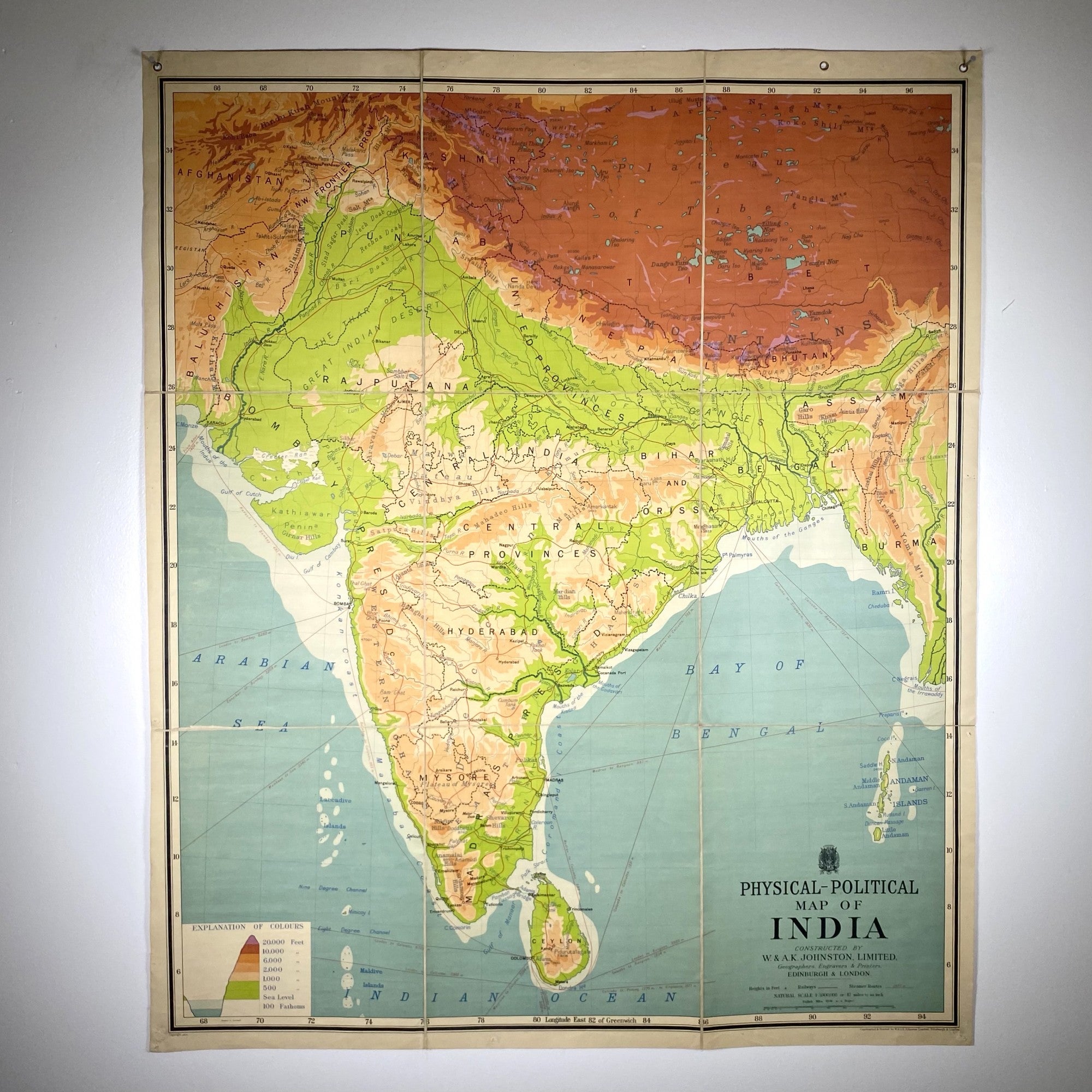
[MAP] PHYSICAL - POLITICAL MAP OF INDIA
Edinburgh & London: W. & A. K. Johnston.
Soft Cover. Large folding map dissected in 9 parts backed in linen, with the topography of the country shown by various colors. The colors are bright, in aquamarine, greens, peaches and reds. Each section is 17” x 14” for a total of 51” x 42”. With grommets for hanging. Covers when folded backed in red, with a small paper label “India Political”.~~Uncommon; not found in Rumsey, nor located on OCLC.
Very Good binding.
Item #292987
Price: $300.00
See all items in
History & Military